
Mobile Mapping LiDAR Systems Market Size and Share
Market Overview
| Study Period | 2020 - 2031 |
|---|---|
| Market Size (2026) | USD 2.67 Billion |
| Market Size (2031) | USD 6.79 Billion |
| Growth Rate (2026 - 2031) | 20.52 % |
| Fastest Growing Market | Asia-Pacific |
| Largest Market | North America |
| Market Concentration | Low |
Major Players *Disclaimer: Major Players sorted in no particular order Image © Mordor Intelligence. Reuse requires attribution under CC BY 4.0. | |
Mobile Mapping LiDAR Systems Market Analysis by Mordor Intelligence
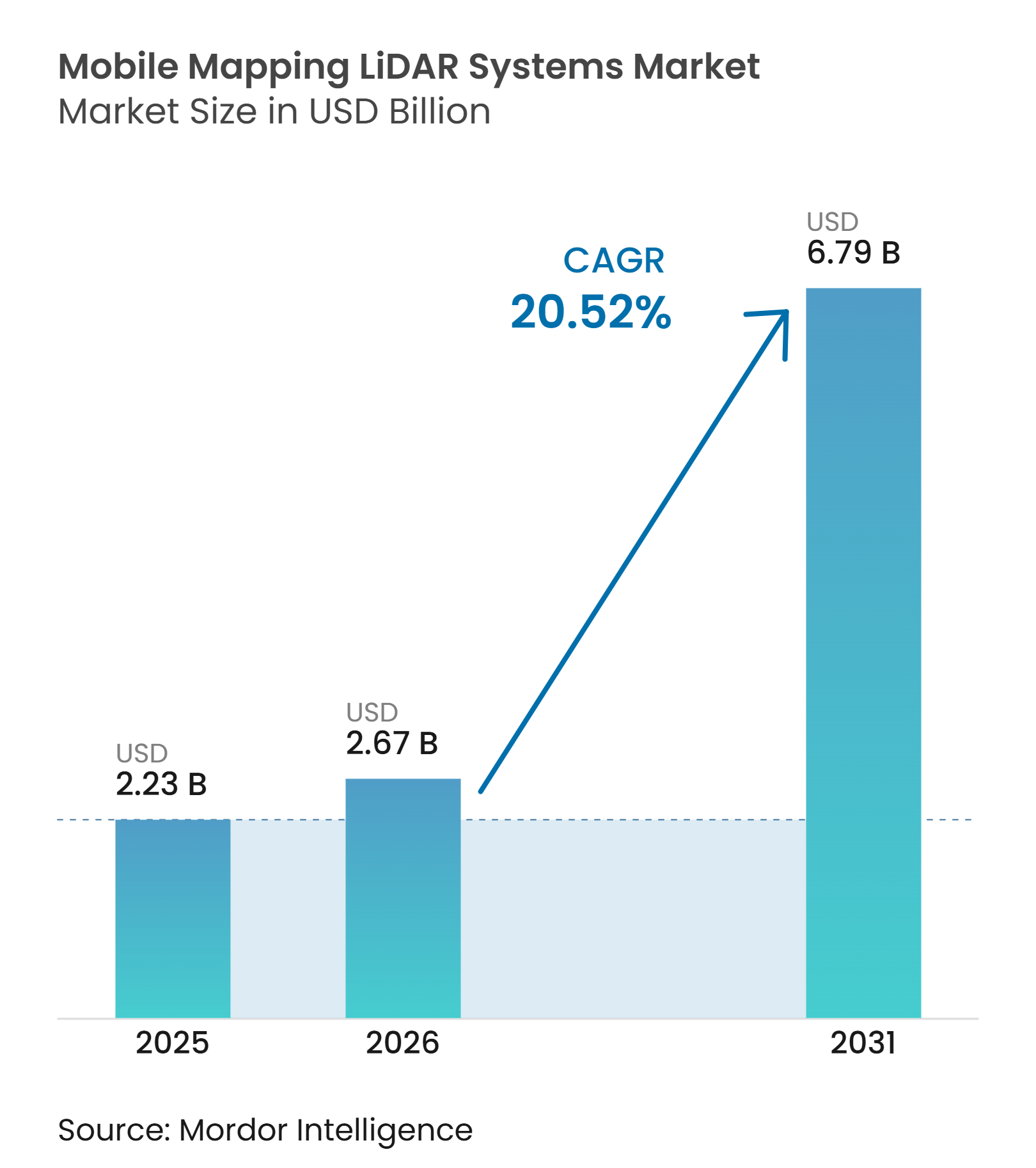
The mobile mapping LiDAR systems market size is projected to expand from USD 2.23 billion in 2025 to USD 2.67 billion in 2026, and to USD 6.79 billion by 2031, registering a CAGR of 20.52% from 2026 to 2031. Government digital-twin programs are making high-resolution 3D data a regular part of infrastructure planning and maintenance. Lower solid-state sensor costs are widening access for municipal agencies and infrastructure contractors. AI-based point-cloud processing is shortening delivery cycles and reducing the manual work required after data collection. This combination supports recurring procurement rather than isolated equipment purchases across the mobile mapping LiDAR systems market. Suppliers are also placing more emphasis on software platforms, data management, and automation to keep customers within their operating ecosystems.
Key Report Takeaways
- By component, hardware accounted for 54.73% of the mobile mapping LiDAR systems market share in 2025, while software is projected to expand at a 22.63% CAGR through 2031.
- By LiDAR sensor architecture, mechanical LiDAR held 61.46% revenue share in 2025, while FMCW/4D LiDAR is projected to expand at a 21.78% CAGR through 2031.
- By mounting platform, vehicle-mounted systems held 67.83% revenue share in 2025, while UAV and drone-mounted systems are projected to expand at a 22.84% CAGR through 2031.
- By end user, government and public sector users held 28.47% revenue share in 2025, while automotive and autonomous mobility are projected to expand at a 22.31% CAGR through 2031.
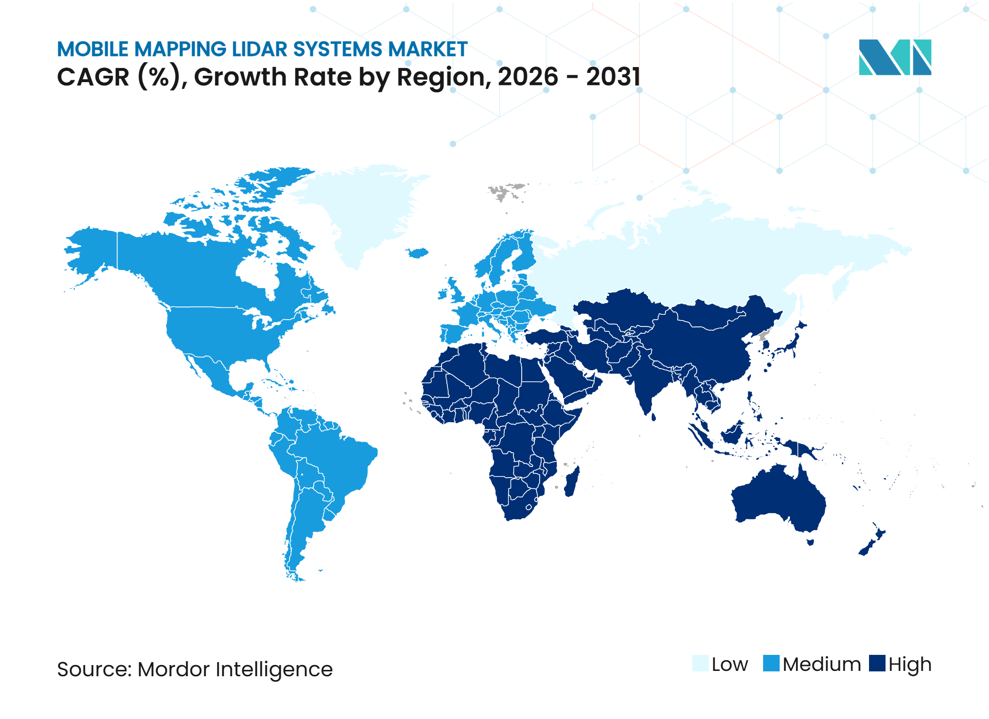
- By geography, North America held 34.82% of the mobile mapping LiDAR systems market share in 2025, while Asia-Pacific is projected to expand at a 22.64% CAGR through 2031.
Note: Market size and forecast figures in this report are generated using Mordor Intelligence’s proprietary estimation framework, updated with the latest available data and insights as of January 2026.
Market Trends and Insights
Drivers Impact Analysis of Mobile Mapping LiDAR Systems Market*
| Driver | (~) % Impact on CAGR Forecast | Geographic Relevance | Impact Timeline |
|---|---|---|---|
| Government Digital-Twin Mandates | +4.5% | Global, with early gains in North America, Europe, and East Asia | Medium term (2-4 years) |
| Declining Solid-State LiDAR Costs | +3.8% | Global, led by Asia-Pacific and North America | Short term (≤ 2 years) |
| AI-Powered Automatic Feature Extraction | +3.2% | Global, with early adoption in North America and Europe | Medium term (2-4 years) |
| Autonomous Robots and Drone Adoption | +2.5% | Global, with rapid uptake in Asia-Pacific and North America | Medium term (2-4 years) |
| Road-Asset Digitization for Wildfire and Climate Resilience | +1.8% | North America, Southern Europe, and Australia | Medium term (2-4 years) |
| High-Frequency Mapping for Autonomous-System Training Data | +1.6% | Global, concentrated in North America, China, and Europe | Short term (≤ 2 years) |
| Source: Mordor Intelligence | |||
Government Digital-Twin Mandates
National digital twin programs are supporting longer procurement cycles in the mobile mapping LiDAR systems market. The SMART Infrastructure Act of 2025 required federal guidelines for digital-twin use in infrastructure permitting, including standards for creating and maintaining digital twins using geographic information systems and environmental sensor data. Germany’s nationwide LiDAR aerial survey was 93% complete in early 2026 and used a minimum density of 40 points per square meter. Such programs require repeated updates, quality controls, and standardized reference data. They therefore favor suppliers that can support acquisition, processing, and data management over multiple years. This demand pattern reduces reliance on short, project-only sales cycles in the mobile mapping LiDAR systems market.
Declining Solid-State LiDAR Costs
Solid-state LiDAR production is increasing the range of systems available to smaller operators. Hesai reported more than 2 million cumulative LiDAR deliveries in 2025 and is expanding annual capacity beyond 4 million units in 2026. The company also reported orders exceeding 4 million units for its ATX long-range LiDAR. Automotive production volumes can lower component costs for sensors later used in mapping payloads. This helps contractors and mid-sized agencies consider systems that were previously outside their capital budgets. The mobile mapping LiDAR systems market can benefit as lighter, lower-cost sensors are adopted by vehicle, drone, and robotic platforms.
AI-Powered Automatic Feature Extraction
Automated classification is becoming increasingly important for firms managing large point cloud volumes. Flai stated that its mobile mapping model separates road corridors into 27 asset classes in one automated pass and reduces processing time by 50% to 99% compared with manual editing. TerraSeg, published at CVPR 2026, processed LiDAR ground segmentation at up to 50 Hz and was trained on nearly 22 million scans from 15 sensors. These tools can reduce the volume of routine work handled by specialized analysts. Experienced staff remains necessary for validation, exceptions, and certified client deliverables. Software capability is therefore becoming a more important selection factor in the mobile mapping LiDAR systems market.
Autonomous Robots and Drone Adoption
Autonomous platforms are extending data collection into places that are difficult for vehicle-based systems to reach. RoboSense reported robotics LiDAR sales of 282,600 units during the first half of 2026, up 510.4% from the prior year. Emesent secured AUD 25 million (USD 16 million) in July 2026 to develop its Cortex AI autonomy platform for GPS-denied mapping.[1] Compact payloads can support work in mines, disaster areas, tunnels, and dense urban locations. Onboard processing also reduces the need for constant manual intervention during routine missions. This expands practical deployment options for the mobile mapping LiDAR systems market.
Restraints Impact Analysis of Mobile Mapping LiDAR Systems Market*
| Restraint | (~) % Impact on CAGR Forecast | Geographic Relevance | Impact Timeline |
|---|---|---|---|
| High System Acquisition and Deployment Costs | -3.5% | Global, most acute in South America, Africa, and the Middle East | Medium term (2-4 years) |
| Shortage of Skilled Survey and Point-Cloud Operators | -2.3% | Global, most acute in developing markets | Long term (≥ 4 years) |
| Data Privacy and Persistent-Surveillance Restrictions | -1.7% | Europe, North America, and India | Medium term (2-4 years) |
| GNSS-Denied Corridor Mapping and Sensor-Fusion Failure Risk | -1.2% | Global, especially dense urban areas and tunnels | Medium term (2-4 years) |
| Source: Mordor Intelligence | |||
High System Acquisition and Deployment Costs
Full system costs remain a barrier despite lower prices for individual sensors. Entry-level vehicle-mounted systems from leading integrators remain in the USD 100,000 to USD 300,000 range. Survey-grade UAV payloads start at USD 15,000 to USD 50,000 before platform, maintenance, and software costs. YellowScan launched its Access rental service in August 2026 to offer payloads without an upfront capital commitment. This model can help project-based buyers and smaller survey firms use advanced equipment. However, long public tender cycles and fragmented operating budgets still slow purchases in parts of the mobile mapping LiDAR systems market.
Shortage of Skilled Survey and Point-Cloud Operators
The supply of trained survey and point-cloud professionals is not rising as quickly as data collection activity. Large national programs need field crews, quality-assurance teams, and certified software analysts. University geomatics programs and surveying apprenticeships can take 3 to 5 years to develop these skills. The UC Institute of Transportation Studies reported that a Los Angeles County wildfire road-resilience project required specialist operators for collection, quality control, and analysis. Automation can reduce repetitive classification tasks, but cannot replace review and deliverable certification. This shortage can limit how quickly providers execute contracts across the mobile mapping LiDAR systems market.
*Our forecasts treat driver/restraint impacts as directional, not additive. The impact forecasts reflect baseline growth, mix effects, and variable interactions.
Mobile Mapping LiDAR Systems Market Segment Analysis
By Component:
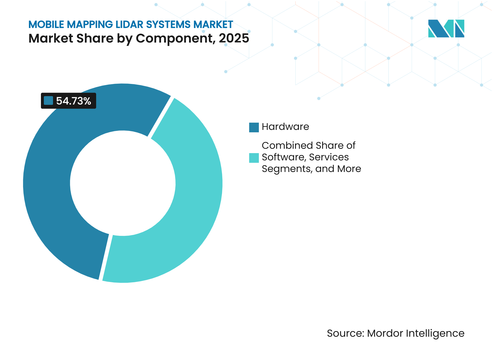
Software Platforms Are Shifting System ValueHardware held 54.73% of the mobile mapping LiDAR systems market share in 2025 because scanner arrays, inertial navigation units, and integrated platforms carry substantial equipment costs. Hardware remains the physical base for every vehicle, drone, handheld, and robotic deployment. Services cover data acquisition, calibration, and managed processing for clients that do not operate systems internally. These offerings allow agencies and contractors to use LiDAR without building a full internal technical team. Software is projected to record a 22.63% CAGR from 2026 to 2031. Growth comes from point-cloud analytics, automated classification, and fleet-management subscriptions. GreenValley International’s LiDAR360 supports classification of more than 32 feature types and integrates the Segment Anything Model for feature extraction from imagery.[2] This gives suppliers a route to recurring revenue alongside equipment sales.
As sensor unit costs decline, software can account for more of the differentiated value in a deployment. System suppliers are increasingly combining processing platforms with hardware packages. RIEGL offers its RiACQUIRE and RiPROCESS platforms alongside its mapping systems. These integrated workflows can limit the difficulty of moving projects to another provider. They also let customers manage capture, processing, and output within one operating environment. For clients, the choice increasingly depends on the usability and reliability of the complete workflow. The mobile mapping LiDAR systems industry is therefore moving toward a model where equipment and analytics are sold together. This change supports vendors with strong processing tools and long-term customer support capabilities.



By LiDAR Sensor Architecture:
FMCW/4D LiDAR Gains GroundMechanical LiDAR accounted for 61.46% of the mobile mapping LiDAR systems market in 2025. It remains widely used for long highway surveys and broad 360-degree coverage. Its established calibration and field service networks also meet many public procurement requirements. RIEGL’s VMX-3HA uses dual VUX-3HA scanners with pulse repetition rates up to 6 MHz and 800 scan lines per second. Solid-state LiDAR is gaining use in backpacks and drones where size and vibration tolerance are important. Hybrid and multisensor systems combine sensor types for variable terrain, utilities, and underground work. These systems support applications that require different fields of view or operating ranges. Mechanical systems nevertheless remain the reference option for many high-accuracy corridor projects.
FMCW/4D LiDAR is projected to grow at a 21.78% CAGR from 2026 to 2031. The technology measures radial velocity and position, thereby supporting moving-object rejection during data capture. Aeva was selected for NVIDIA’s DRIVE Hyperion reference platform in January 2026, with production vehicle integration targeted for 2028. FMCW sensors can also reduce solar interference and inter-sensor crosstalk. Those properties may be useful in dense urban mapping environments. Adoption is currently shaped by automotive development pipelines and survey-grade trials. The mobile mapping LiDAR systems market can gain from shared component development between automotive and mapping applications.
By Mounting Platform:
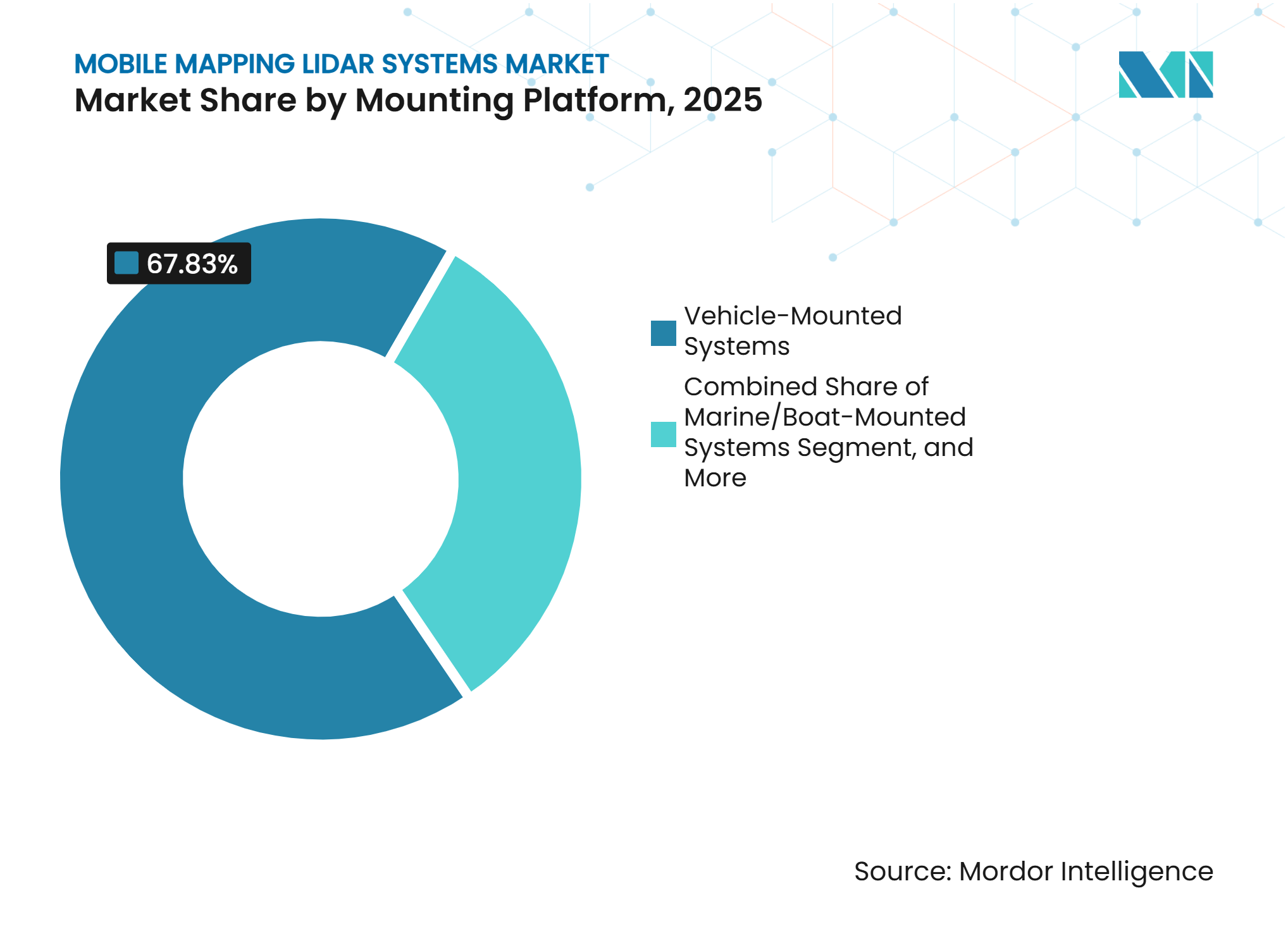
UAV Systems Extend Field CoverageVehicle-mounted systems held 67.83% of revenue in 2025. Transportation agencies have long used mapping vehicles for highway and road corridor surveys. Fleet-based procurement also supports repeatable collection across large networks. Railway-mounted systems serve track geometry, clearance inspections, and asset inventories at operating speeds. They allow data collection without scheduling lengthy track closures. UAV and drone-mounted systems are projected to grow at a 22.84% CAGR from 2026 to 2031. Their lighter payloads can extend flight duration while covering locations beyond road access. This platform is well-suited to corridor inspection, vegetation analysis, and remote infrastructure work.
YellowScan introduced the Mapper Ultra in June 2026 with 500,000 points per second and up to 7 returns in a 1.94-kilogram package. Backpack, handheld, and pole-mounted systems are also becoming more common in indoor and constrained locations. Emesent launched the GX1 in February 2026, combining SLAM and RTK positioning with 5-10 mm global accuracy. These devices serve tunnels, heritage sites, and urban locations where vehicle access is limited. Marine systems support mapping of port, riverbank, and coastal assets. Public contracts often require ISO 17025 calibration traceability for survey-grade work. This favors providers with documented calibration processes across multiple mounting platforms. The mobile mapping LiDAR systems market is thus broadening beyond conventional road-based capture.

By End User:
Autonomous Mobility Changes Mapping DemandGovernment and public-sector users accounted for 28.47% of revenue in 2025. National mapping agencies, transportation departments, and municipalities use mobile LiDAR for road inventory and infrastructure monitoring. Their programs are linked to digital-twin requirements and standardized public asset records. Transportation and infrastructure users form the second-largest buyer group. They commission roadway and railway surveys for maintenance, safety analysis, and pavement monitoring. Automotive and autonomous mobility are projected to grow at a 22.31% CAGR through 2031. Level 3 and Level 4 systems require repeated and accurate mapping of road networks. Historical mapping databases alone cannot meet these requirements for data freshness and coverage.
Aeva released AevaScenes in September 2025 as an open-access dataset combining FMCW 4D LiDAR and camera data with velocity measurements and semantic annotations AEVA. This supports development work for autonomous perception systems. Energy and utility operators use mobile LiDAR for power-line clearance, pipeline route surveys, and solar site surveys. Construction, real estate, mining, natural resources, defense, and security users apply the technology to monitoring, volumetric work, and terrain analysis. Rugged handheld and drone systems are replacing some terrestrial scanning tasks in hazardous or confined sites. These users value faster collection cycles and access to difficult terrain.
Geography Analysis
North America accounted for 34.82% of the mobile mapping LiDAR systems market in 2025. The region’s position reflects federal and state highway programs, defense-related mapping budgets, and a large concentration of autonomous vehicle development. Nevada’s Department of Transportation issued a procurement for a statewide mobile mapping system and LiDAR data platform to modernize roadway data collection. Caltrans published its 2026 Climate Vulnerability and Risk Assessment framework, which used mobile LiDAR-derived elevation and asset data for wildfire exposure indicators.[3] Federal procurement restrictions also favor systems that meet applicable supply-chain requirements.
Europe held the second-largest share in 2025. Advanced geospatial agencies and environmental survey requirements support the need for recurring data collection. Germany’s national survey used 7 contractors across 8 lots, with the remaining areas planned for scanning from March through May 2026. Data privacy rules affect operators that collect street-level images with LiDAR point clouds. Providers must address the handling of faces, license plates, and other identifiable data before transfer. South America, the Middle East, and Africa remained smaller markets, with early use in mining, oil and gas corridors, and urban infrastructure programs.
Asia-Pacific is projected to grow at a 22.64% CAGR from 2026 to 2031. The region combines fast infrastructure digitization with growing domestic sensor production. Hesai is expanding manufacturing capacity beyond 4 million units annually in 2026. Japan’s adoption is tied to replacement cycles and autonomous-driving research in the Nagoya and Tokyo areas. India is moving from point-based GPS surveys toward fleet-scale mapping for highways and advanced driver-assistance applications. National interoperability and calibration standards in China and Japan also influence tender criteria and market entry for foreign suppliers.
Competitive Landscape
Market Concentration
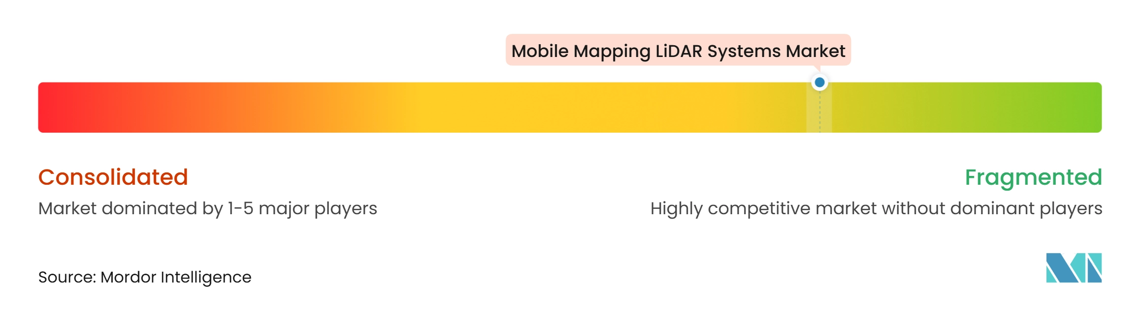
The mobile mapping LiDAR systems market is moderately fragmented across platform types and application tiers. RIEGL and Teledyne Optech are established in high-end vehicle and railway applications. Their long-range mechanical scanners, calibration networks, and reference status in tenders strengthen their positions. Hesai and RoboSense are expanding their international presence through vertically integrated sensor production. RoboSense reported 719,200 LiDAR shipments in the first half of 2026, a 169.6% increase from the prior year.[4] Procurement restrictions in some public contracts limit the addressable market for certain lower-cost systems. UAV competition includes YellowScan, Emesent, Routescene, and Livox, with buyers comparing payload mass, ruggedness, returns, and software compatibility.
Companies are linking hardware with SLAM algorithms, cloud tools, and automated classification. Emesent’s Cortex AI and Aura cloud platform are examples of this approach. The company secured AUD 25 million (USD 16 million) in July 2026 to scale these platforms. In February 2026, YellowScan and Cellen H2 announced that YellowScan systems would be integrated with the Cellen H2-6 hydrogen-powered drone. The partnership extends flight endurance for long-range survey and corridor monitoring missions. These moves show how suppliers are developing complete operating systems rather than isolated sensors. The mobile mapping LiDAR systems market increasingly rewards firms that combine capture hardware with usable data workflows.
GNSS-denied mining sites, railway tunnels, and dense urban locations remain important areas for product development. FMCW/4D LiDAR is another developing area for survey-grade applications. RoboSense stated that its Phoenix chipset received AEC-Q100 Grade 1 certification for automotive electronics. This can support vehicle-integration quality requirements on mobile platforms. Suppliers that adapt automotive-grade components to survey accuracy needs can improve their competitive position. The mobile mapping LiDAR systems industry remains open to specialized providers that address difficult operating conditions. The competitive field therefore contains established integrators, high-volume sensor producers, and software-focused platform suppliers.
Mobile Mapping LiDAR Systems Industry Leaders
-
RIEGL Laser Measurement Systems GmbH
-
Teledyne Optech Incorporated
-
SICK AG
-
YellowScan SAS
-
Emesent Pty Ltd
- *Disclaimer: Major Players sorted in no particular order
Mobile Mapping LiDAR Systems Market Companies Covered in this Report
- RIEGL Laser Measurement Systems GmbH
- Teledyne Optech Incorporated
- SICK AG
- YellowScan SAS
- Emesent Pty Ltd
- Routescene Limited
- GreenValley International Inc.
- JAWESO GmbH
- NavVis GmbH
- Kaarta Inc.
- Viametris SAS
- OxTS Ltd
- SBG Systems SAS
- Hesai Technology Co., Ltd.
- Ouster, Inc.
- Aeva, Inc.
- RoboSense Technology Co., Ltd.
- Livox Technology Company Limited
- XenomatiX NV
Recent Industry Developments in Mobile Mapping LiDAR Systems Market
- August 2026: Emesent secured AUD 3 million (USD 1.9 million) from Australia’s Cooperative Research Centres Projects program to develop and commercialize Cortex AI, an open modular autonomy platform enabling robotic systems to navigate, map, and operate in GPS-denied and hazardous environments. The development shifts Emesent toward an open-platform business model.
- August 2026: YellowScan launched YellowScan Access, a UAV LiDAR rental service offering the company’s full payload range without upfront capital commitment. The service targets smaller survey operators and project-based buyers in the mobile mapping LiDAR systems market. It gives these organizations a way to use advanced systems while retaining flexibility for changing project volumes and contract requirements.
- July 2026: Emesent announced AUD 25 million (USD 16 million) in funding, including a AUD 10 million (USD 6.4 million) venture debt facility and a AUD 15 million (USD 9.6 million) equity round. Main Sequence, QIC Ventures, Orion Resource Partners, Hostplus, and NGS Super supported the equity round. The funding will scale Cortex AI and Aura cloud software.
- July 2026: RoboSense unveiled E2, its fully solid-state digital LiDAR built on the EOCENE SPAD-SoC architecture with the self-developed Peacock chipset. It was presented at the World Artificial Intelligence Conference in Shanghai. The system targets autonomous mobile robots, ADAS vehicles, and physical AI applications in the mobile mapping LiDAR systems market.
Global Mobile Mapping LiDAR Systems Market Report Scope
Mobile mapping LiDAR systems use light detection and ranging (LiDAR) technology mounted on vehicles, drones, or other mobile platforms to capture high-precision three-dimensional spatial data. These systems support applications such as road surveying, infrastructure inspection, urban planning, autonomous vehicle development, and asset management by enabling rapid and accurate mapping of large areas.
The Mobile Mapping LiDAR Systems Market Report is Segmented by Component (Hardware, Software, and Services), LiDAR Sensor Architecture (Mechanical LiDAR, Solid-State LiDAR, FMCW/4D LiDAR, and Hybrid/Multisensor LiDAR), Mounting Platform (Vehicle-Mounted Systems, Railway-Mounted Systems, UAV/Drone-Mounted Systems, Backpack, Handheld and Pole-Mounted Systems, and Marine/Boat-Mounted Systems), End User (Government and Public Sector, Transportation and Infrastructure, Energy and Utilities, Construction and Real Estate, Mining and Natural Resources, Automotive and Autonomous Mobility, Defense and Security, and Other End-User Industries), and Geography (North America, South America, Europe, Asia-Pacific, Middle East, and Africa). The Market Forecasts are Provided in Terms of Value (USD).
Segmentation Overview
| Hardware |
| Software |
| Services |
| Mechanical LiDAR |
| Solid-State LiDAR |
| FMCW / 4D LiDAR |
| Hybrid / Multisensor LiDAR |
| Vehicle-Mounted Systems |
| Railway-Mounted Systems |
| UAV/Drone-Mounted Systems |
| Backpack, Handheld and Pole-Mounted Systems |
| Marine/Boat-Mounted Systems |
| Government and Public Sector |
| Transportation and Infrastructure |
| Energy and Utilities |
| Construction and Real Estate |
| Mining and Natural Resources |
| Automotive and Autonomous Mobility |
| Defense and Security |
| Other End-User Industries |
| North America | United States |
| Canada | |
| Mexico | |
| South America | Brazil |
| Argentina | |
| Chile | |
| Rest of South America | |
| Europe | Germany |
| United Kingdom | |
| France | |
| Italy | |
| Spain | |
| Rest of Europe | |
| Asia-Pacific | China |
| Japan | |
| India | |
| South Korea | |
| Australia | |
| Rest of Asia-Pacific | |
| Middle East | United Arab Emirates |
| Saudi Arabia | |
| Turkey | |
| Rest of Middle East | |
| Africa | South Africa |
| Egypt | |
| Rest of Africa |
| By Component | Hardware | |
| Software | ||
| Services | ||
| By LiDAR Sensor Architecture | Mechanical LiDAR | |
| Solid-State LiDAR | ||
| FMCW / 4D LiDAR | ||
| Hybrid / Multisensor LiDAR | ||
| By Mounting Platform | Vehicle-Mounted Systems | |
| Railway-Mounted Systems | ||
| UAV/Drone-Mounted Systems | ||
| Backpack, Handheld and Pole-Mounted Systems | ||
| Marine/Boat-Mounted Systems | ||
| By End User | Government and Public Sector | |
| Transportation and Infrastructure | ||
| Energy and Utilities | ||
| Construction and Real Estate | ||
| Mining and Natural Resources | ||
| Automotive and Autonomous Mobility | ||
| Defense and Security | ||
| Other End-User Industries | ||
| By Geography | North America | United States |
| Canada | ||
| Mexico | ||
| South America | Brazil | |
| Argentina | ||
| Chile | ||
| Rest of South America | ||
| Europe | Germany | |
| United Kingdom | ||
| France | ||
| Italy | ||
| Spain | ||
| Rest of Europe | ||
| Asia-Pacific | China | |
| Japan | ||
| India | ||
| South Korea | ||
| Australia | ||
| Rest of Asia-Pacific | ||
| Middle East | United Arab Emirates | |
| Saudi Arabia | ||
| Turkey | ||
| Rest of Middle East | ||
| Africa | South Africa | |
| Egypt | ||
| Rest of Africa | ||
Key Questions Answered in the Report
What is the mobile mapping LiDAR systems market size?
The 2026 value is USD 2.67 billion and is projected to reach USD 6.79 billion by 2031 at a 20.52% CAGR.
What is driving demand for mobile mapping LiDAR systems?
Digital-twin programs, lower solid-state sensor costs, automated feature extraction, and autonomous platforms are supporting demand. These factors improve access to survey-grade equipment and increase the value of updated infrastructure data within the mobile mapping LiDAR systems market.
Which component is growing fastest through 2031?
Software is projected to grow at a 22.63% CAGR as users adopt analytics, classification, and fleet-management tools. These tools can reduce routine processing time and support ongoing subscription revenue for suppliers.
Which LiDAR architecture is expected to grow the fastest?
FMCW/4D LiDAR is projected to expand at a 21.78% CAGR through 2031 because it measures velocity and position together. This capability helps manage moving objects during data collection in complex locations.
Which mounting platform is growing fastest?
UAV and drone-mounted systems are projected to grow at a 22.84% CAGR through 2031 as lightweight payloads support remote data collection. They are suitable for corridors, vegetation, hazardous sites, and other areas where road access is limited.
Which region is projected to expand the fastest?
Asia-Pacific is projected to grow at a 22.64% CAGR through 2031, supported by infrastructure digitization and domestic sensor production. The mobile mapping LiDAR systems market in the region is also supported by highway mapping and national standards.