Market Trends of Satellite-based Earth Observation Industry
Urban Development to be the Fastest Growing Application
- The government initiatives to support new startups in urban development are likely to drive market growth. For instance, in December 2023, the Indian nodal agency in the Department of Space, in collaboration with the National Remote Sensing Center, launched a seed fund scheme to support startups operating in urban development and disaster management using space technology.
- With financial assistance, the startups are expected to develop applications of EO data for urban planning and development. This could lead to the creation of new services that address critical challenges in urban development. Further, the growth in the number of startups with EO-based solutions is expected to broaden the range of services available.
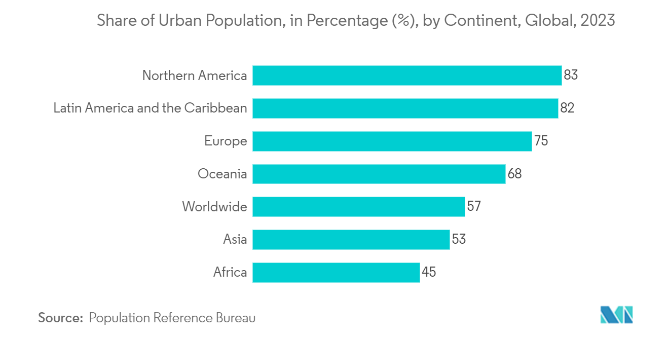
- The growing investment in urban development due to the rapidly growing urban population creates the need for infrastructure facilities that support market growth. According to the Population Reference Bureau, in 2023, the degree of urbanization globally was 57 percent. North America, Latin America, and the Caribbean were the regions with the highest level of urbanization, with over four-fifths of the population residing in urban areas.
- In 2022, the US Department of Housing and Urban Development reported spending around USD 29.31 billion. Projections from the US Office of Management and Budget anticipate this figure will rise to approximately USD 80.26 billion by 2028.
- Recently, the market vendor Satellogic, a high-resolution satellite imagery provider, collaborated with GeoterraImage to introduce a fully automated building development detection and monitoring system to the South African market. This system offers an efficient and cost-effective solution for monitoring and mapping new developments for municipalities and provincial governments in South Africa.
Understand The Key Trends Shaping This Market
Download Sample
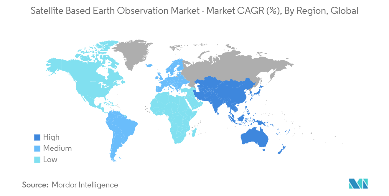
North America to Hold Significant Market Share
- North America is experiencing a surge in demand for satellite-based Earth observation, driven by sectors like agriculture, environment, and defense seeking high-resolution data. Satellite imagery plays a crucial role in monitoring environmental issues across North America's vast and remote landscapes. For instance, the National Oceanic and Atmospheric Administration (NOAA) satellites provide weekly analysis of ozone levels, track iceberg movements, and offer data on events like bushfires and thunderstorms. Such information aids in formulating data-driven policies for sustainable resource management.
- As defense forces face evolving threats, including insurgency tactics and virtual warfare, intelligence gathering becomes as vital as on-the-ground operations. Geospatial tools empower defense forces to plan, monitor, and counter potential dangers.
- The North American region is witnessing increased investments in its defense sector, presenting opportunities for market players. In FY2024, the US Department of Defense (DOD) requested a budget of USD 26.1 billion, marking a USD 4.4 billion increase from its FY2023 request. Additionally, in November 2023, India and the United States announced plans to launch a joint microwave remote sensing satellite, named NASA-ISRO Synthetic Aperture Radar (NISAR), in early 2024.
- Urban development is a prominent application driving the demand for satellite imagery in North America. High-resolution satellite images enable detailed assessments of urban areas, including road networks, infrastructure, and land cover changes. In response to this demand, regional players are launching satellite imagery programs.
- For instance, in March 2024, the Vexcel Data Program expanded its annual aerial imagery collection in the US, covering 4.4 million km square in the Lower 48 states. This represents a 15% increase in coverage compared to the previous year, with a focus on urban areas at a detailed 7.5 cm resolution. Major cities and urban areas will be imaged up to 3 times annually.
- The satellite imagery market is witnessing a notable uptick, driven by its growing importance across sectors and increased government investments, particularly in areas like environment and defense.
Get Analysis on Important Geographic Markets
Download Sample
