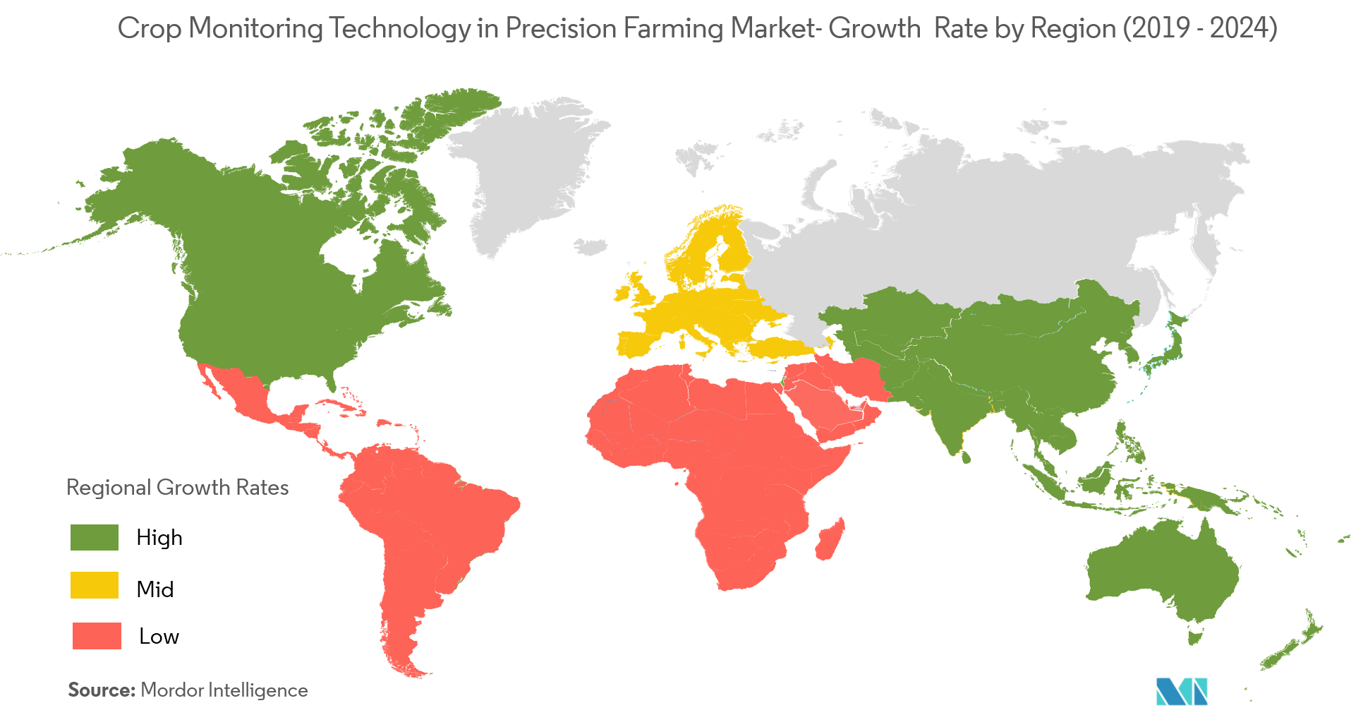
Market Trends of Crop Monitoring Technology in Precision Farming Industry
This section covers the major market trends shaping the Crop Monitoring Technology in Precision Farming Market according to our research experts:
GPS and GNSS Adoption to Drive the Market Growth
- Miniaturization and improved accuracy of the global navigation satellite system (GNSS) technology (of which, GPS is mostly in use, at present) makes it possible for wide-scale adoption of precision farming technologies for geo-positioning and field mapping.
- The United States is the leading country, in terms of the GNNS/GPS technology used in agriculture. Nearly 70% of the advanced technologies in the US farms are using some level of GPS/GNSS.
- GPS-based applications in precision farming include major areas, such as yield mapping and monitoring, and farm planning, along with field mapping, soil sampling, tractor guidance, crop scouting, variable rate applications.
- Therefore, with increased adoption of GPS and GNSS, coupled with the benefits offered, the demand for crop monitoring is set to increase over the forecast period.
Understand The Key Trends Shaping This Market
Download Sample
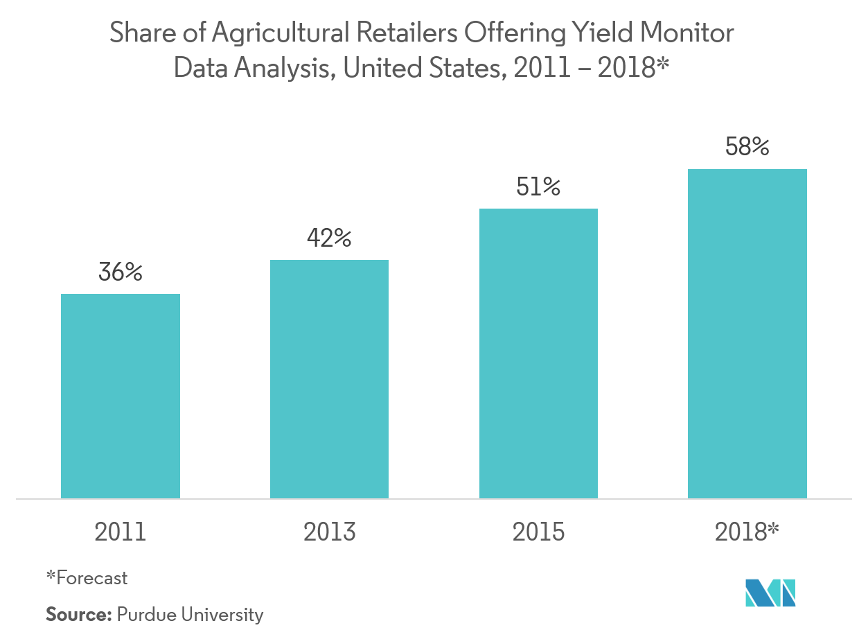
United States to Account for the Largest Share
- As per the estimates of the US Department of Agriculture, nearly 2,029,200 farms in the United States used 950 million acre land, in 2017. With a huge dependency on the agriculture sector, the government in the country is increasingly focusing on implementing precision farming technologies.
- The key agencies responsible for the uprising in large-scale agriculture in the United States include NASA, NOAA, and the US Department of Agriculture. Their goal is to improve farmer’s profitability and reduce the environmental concerns caused due to the application of various chemicals.
- Moreover, although the Federal Aviation Administration (FAA) had laid out restrictions on the flying of drones, as per their new rules passed in 2016. Drones for commercial purposes, weighing up to 55 lb, can be used in the United States during daylight hours. These initiatives have aided the adoption of precision farming in the country.
- Further, according to the Farm Profits and Adoption of Precision Agriculture study in 2017, yield mapping is used on about 40% of US corn and soybean acres, GPS soil maps on about 30%, guidance on over 50%, and VRT on 28-34% of acres.
Get Analysis on Important Geographic Markets
Download Sample
